


Geographic Information Systems (GIS) allows us to manage, capture, manipulate, analyze, and present data in a geographic format. This powerful technology gives us a more in-depth look into a project by taking the tabular data that has geographic information and overlaying it with additional data.
Our Approach
Our experienced team of GIS technicians are skilled at taking data and translating it into graphic information. This then becomes a valuable tool for municipalities and other clients to use with urban renewal and planning, transportation planning, environmental impact analysis, and natural resource management.
Our GIS Services include:
- Advanced Geospatial Analysis and Modeling
- Aerial Photography and Satellite Imagery Analysis
- Database Management
- Custom Web Map Development
- 3D Modeling and Animation Rendering
- Hydraulic Modeling
- Survey and AutoCAD Integration
- Advanced Editing
- Cut/Fill Analysis
- Collection and Manipulation of GPS Data
- Cartography
- Marketing Analysis
- Graphics Production
Recent Projects
Here is some of our recent GIS work:

City of Yamhill Water Distribution Source Study
Public Works
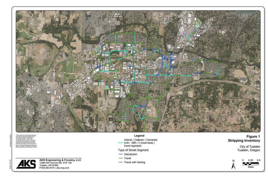
City of Tualatin Street Striping Inventory
Public Works

Multnomah County Drainage District Turtle Study
Environmental